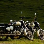
Many people believe this Manali to Leh Highway has the answers to all your adventurous callings. Every time you scroll up the Social Media there will be this one post which asks you to quit and travel, or takes that bike of yours to set out on the roads. And eventually, you end up thinking of this magical enticing journey from Manali to the Leh. The purist will vouch for the ever-changing landscape, the mighty mountain passes, majestic valleys, serene amber lakes, raging rivers and inexhaustible plateau.
Manali to Leh Highway Map

https://www.google.com/maps/embed?pb=!1m76!1m12!1m3!1d1709504.9087502286!2d76.32379201299348!3d33.191103354278326!2m3!1f0!2f0!3f0!3m2!1i1024!2i768!4f13.1!4m61!3e0!4m5!1s0x39048708163fd03f%3A0x8129a80ebe5076cd!2sManali%2C+Himachal+Pradesh!3m2!1d32.2396325!2d77.1887145!4m5!1s0x39047f9ca7eb3d4f%3A0xe37272d33575200f!2sKoksar+Bus+Stop%2C+Leh+Manali+Hwy%2C+Khoksar%2C+Himachal+Pradesh+175140!3m2!1d32.4145762!2d77.23484599999999!4m5!1s0x390377d3b5f3613d%3A0x39eb649cdd83bfde!2sJispa%2C+Himachal+Pradesh!3m2!1d32.6390155!2d77.18518069999999!4m5!1s0x3903c74b14340d3b%3A0x2e0d5eda17e7d728!2sSarchu%2C+Himachal+Pradesh!3m2!1d32.9070162!2d77.5812849!4m5!1s0x3903d24978088d49%3A0x2a67de735a9c1148!2sPang!3m2!1d33.1299062!2d77.7874026!4m5!1s0x390222e717a9a58d%3A0x66e6e0cd0d7b9601!2sTanglang+La!3m2!1d33.5078142!2d77.7698901!4m5!1s0x390219f8042bc2f1%3A0x4872045e4e653bf0!2sRumtse!3m2!1d33.6340827!2d77.7537913!4m5!1s0x390206be0237201d%3A0xe0c38a691928eee9!2sUpshi!3m2!1d33.83036!2d77.8142127!4m5!1s0x38fdf78c0c93b979%3A0xe3a63b2c7ae86dd0!2sKaru!3m2!1d33.9199287!2d77.7380549!4m5!1s0x38fdeb21445fed85%3A0xd1bb09975086f710!2sLeh!3m2!1d34.1525864!2d77.57705349999999!5e0!3m2!1sen!2sin!4v1530954686404
Manali to Leh Highway Details
The celebrated 490 kms long Manali to Leh highway starts from Manali town in Himachal Pradesh to Leh city in Ladakh region of J&K. This highway is open for around four and half months in a year from June to mid-October when snowfall on High Mountain passes closes the highway, with 230 kms of it in Himachal and rest of it in J&K. The average elevation of Leh-Manali highway is more than 4,000 m (13,000 feet) maxing out at Tanglang La-5,328 m (17,480 ft).
The journey from Manali to Leh can be done comfortably in 2-3 days, but it’s suggested you break it down into a few memorable pit stop (literally).
Manali-Gulaba-Marhi-Rohtang Pass
Manali- One of the most sought after hill station of India is where your journey start and also you get the permit for Rohtang Pass, which is must travel beyond Rohtang. Make sure to start up early in the morning to beat the tourist thronging Rohtang for some snow sighings and slinging.
 [Water Crossing at Rohtang Pass]
 [Climbing Rohtang]
At a distance of around 15 Kms from Manali is Gulaba- the Checkpost for permit scrutinisation. Marhi is the place to have some scrumptious breakfast with a precursor of the views which will eventually grow more awe-inspiring later. 16 kms post-Marhi at Rohtang you actually to get to experience some breathtaking vistas.
Rohtang Pass-Gramphu-Koksar
It’s a downhill Rohtang Pass to Koksar terrain wise, but it’s an uphill task especially for riders testing their prowess off the road to the fullest.
Just before Koksar (register here with local police for a smooth journey onwards) there is a diversion for Gramphoo- where you detour for Spiti Valley
Koksar-Sissu-Tandi
You will find some pitch straight roads along with the Chandra River running with for company till Tandi. Here one brings the fuel tanks to a brim and gets to use those jerry cans for the first as next fuel bunk stands 375 Kms away.
 [Sissu Waterfall]
Tandi-Keylong-Jispa
Keylong being the district headquarters of Lahaul-Spiti is a place of importance for the locals as well as the road travellers alike. From vehicle service stations to a comfortable hotel, this place has got it all which makes it a perfect transition point to call it a night.
 [Going to Keylong]
If you fancy a tent set beside the Chandra River, Jispa a small village a few km from Keylong makes for a good choice than the later.
 [Chandra River]
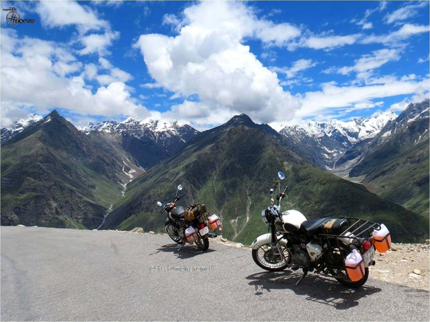
Jispa-Darcha-Patsio-Zingzing Bar-Baralacha La-Sarchu
As you start in the morning further for Sarchu this highway throws a lot of water bodies at you in the form of water crossing and the serene view of the fame Deepak Taal and Suraj Taal. Cross the Baralacha La along the way and you are bound to see snow here as it is covered with snow all throughout the year.
 [Climbing Baralacha La]
[A view near Baralacha La]
 [A Beautiful View at Darcha]
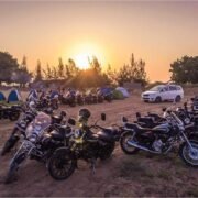
Sarchu is the last town of Himachal, a perfect place to put up for the night as you say goodbye to the state. Stay at this place will be an actual help as it prevents being hit by Acute Mountain Sickness as one acclimatizes. (Also read: Acute Mountain Sickness)
 [Tents at Sarchu]
Sarchu-Gata Loops-Nakee La- Lachulung La-Pang
After few Kilometers from Sarchu, Gata Loops starts which are a series of 21 Criss cross bends. You gain elevation at a rapid pace as you cross Gata Loops and eventually you reach Nakee La the next pass on the highway. After some descend you again have to ascend to Lachulung La. Descending from Lachulung La and some of the most treacherous patches of the road you finally reach Pang which has the distinction of world’s highest Army Transit camp and yes you can also camp here too.

Pang-Moore Plains-Tanglang La-Upshi-Karu-Leh
After climbing few kms from Pang you will witness Moore Plains. Anyone will be spellbound by the sheer enormity of Moore Plains.
 [Moore Plains]
Post Moore plains ascend to Tanglang La begins which is considered to be the second highest motorable pass in the world. Do not spend much time here as there are chances of getting stuck by AMS are high here. While descending from Tanglang La road conditions start to improve.
[Tanglang La with Altitude of 5328 Meters]
Stop at Upshi for a cup of tea and make entries at police check post. The beautiful and straight road along the mighty Indus brings you an alluring gate which reads-“Welcome to Leh”
Want to Explore Leh-Ladakh on Bike? Check out the Package!
Distances on Manali-Leh Highway
- Manali-Rohtang Pass (51 KMs)
- Rohtang Pass-Keylong (65KMs)
- Keylong-Jispa (23 KMs)
- Jispa-Sarchu (85Kms)
- Sarchu-Pang(80 KMs)
- Pang – Upshi (125 KMs)
- Upshi – Leh (50 KMs)
Must Visit Places on Manali-Leh Highway
- Rohtang Pass
- Famous Tandi Petrol Pump
 [We are at Tandi Petrol Pump]
- A confluence of Chandra and Bhaga Rivers
- Deepak Taal
- Suraj Taal
- Baralacha La, Nakee La, Lahulung La, Tanglang La
- Moore Plains
- Thiksey Monastery
- Shey Palace
- 3 Idiots School
Also Read: ANCIENT MONASTERIES OF LADAKH
Some Important Information
1. Accommodation
All the towns on this route have some kind of accommodation. Hotels are available in Manali, Keylong, Jispa. Guest houses are available in Manali, Keylong, Jispa, Upshi. Good Camping options are present in Manali, Keylong, Jispa, Sarchu. Apart from this, you can find banjara or chadar tents at Darcha, Zingzing Bar, Sarchu, Pang. You can choose any option depending on your budget.
2. Mobile Connectivity
Prepaid connections do not work in this region. A post-paid connection that too BSNL and Airtel will be your best bet on this route.
3. Fuel or Petrol Pump
Fuel or petrol pumps are available at Manali, Tandi, Karui, and Leh.
4. Manali-Leh Highway Status
The 490 KM long Manali Leh Highway generally remains closed for about 8 months in a year starting from October to May due to heavy snowfall on the mountain passes mainly Rohtang Pass and Baralacha La pass. But the best season to travel on Manali-Leh highway is between June to October.